信息化教学技术在遥感实验课程中的应用与分析

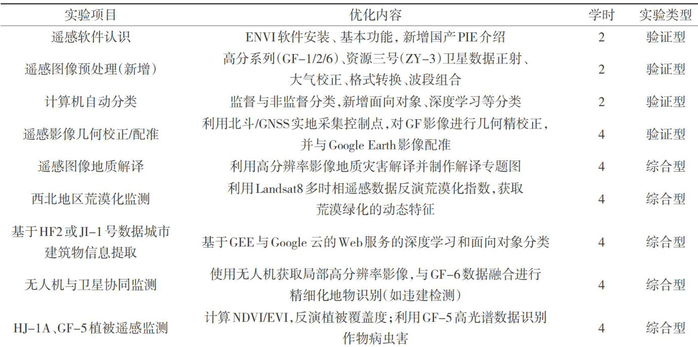
打开文本图片集
中图分类号:G642;P237-4 文献标识码:A文章编号:1672-3791(2026)02-0203-04
Application and Analysis of Information Teaching Technology in Remote Sensing Experiment Course
Kelimu Aerdake WEI Wenyu WANG JunzhiZHANG Yabo
Xinjiang Institute of Engineering, Urumqi, Xinjiang Uygur Autonomous Region, 835ooo China Abstract: The development of Artificial Intellgence (AI) and information technology has pointedout a new direction forthe discipline of surveying and remote sensing.The traditional teaching methods adopted in previoustll followed the conventional educationalmodel,ignoring the innovation of remote sensing applications brought byAI technology and information platforms.In response to the excesive singlenessof teaching methods in remote sensing experiments,an attempt has been made to integrate a inteligentteaching platform into remote sensing experiment courses,which has stimulated studentsinterestand enthusiasm for learningand achieved good educational reform results. At the same time,it can also provide reference for the teaching of surveying and mapping majors.
Keywords: Informatization; Engineering case; Remote sensing experiment; Artificial intelligence
随着大数据时代的不断发展,深度学习、互联网、数字城市、云计算、人工智能(ArtificialIntelligence,AI)大语言模型等新兴信息化与数字化技术正积极推动我国高校教育教学改革,提高教学的质量与效率[1-2]。(剩余4231字)