融合无人机影像与激光点云的地形断面测绘方法研究

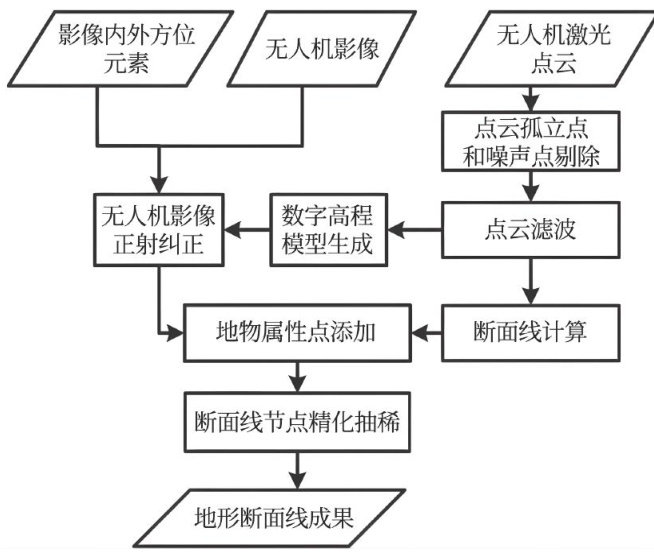
打开文本图片集
中图分类号:P231 文献标识码:A文章编号:1672-3791(2026)02-0172-03
Research on Terrain Profile Surveying and Mapping Method Integrating UAV Images and Laser Point Clouds
LIU Dongming
China Railway Eryuan Engineering Group Co.,Ltd.,Chengdu, Sichuan Province, 61Oo31China Abstract:Byanalyzing and optimizing key technologies such as laser point cloud asisted UAV imageorthorectification,terrinsection production considering terain semantic information,andrefinementand thinningof terrain sectionresults,a terain sectionsurveying and mapping method that integrates UAV images and laser point clouds is studied.The spatial three-dimensional coordinate information of laser point clouds and the spectral texture information ofimages are fused to ensure the accuracyof terrain section lines and obtain land feature atribute information, forminga complete high-accuracy and fast surveying and mapping method for terrin section lines,greatly improving the eficiency and economy of terrain section production,and holds substantial engineering application value.
Keywords: Orthophoto; Laser point cloud; Fusion processing; Terrain profile
在铁路、公路等线性交通工程的勘察与设计中,地形断面能够直观反映地表起伏特征,是路线比选、工程量计算与结构设计的重要基础数据,在工程勘察与测绘生产中具有广泛的应用价值。(剩余3540字)