机载激光雷达与无人船单波束在地表液态水储存量调查中的应用

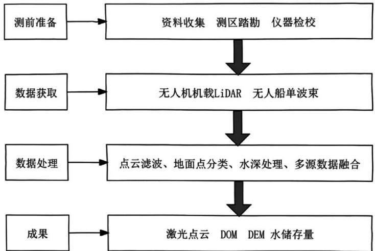
打开文本图片集
DOI:10.19981/j.CN23-1581/G3.2026.12.034
中图分类号:P237
文献标志码: A
文章编号:2095-2945(2026)12-0136-04
Abstract: The survey of ground liquid water storage is one of the core tasks of the survey of water resources of the Ministry of Natural Resources. It involves a large amount of field measurement work and complex data processing. This paper proposes a method for investigating ground liquid water storage in which a single beam cooperative operation of unmanned aerial vehicle (UAV) laser radar (LiDAR) and unmanned ship is operated. Based on the terrain data obtained by UAV and unmanned ship, and using professional software, an integrated digital elevation model on water and water for specific water areas is established, and the water storage of specific water bodies is obtained. The research results show that this method can be suitable for water storage surveys of different water body types and can effectively support the survey of surface liquid water storage.
Keywords: survey of water resources; surface liquid water storage survey; UAV LiDAR measurement; unmanned vessel single beam measurement; survey method
水资源基础调查是自然资源部部署的,以切实履行自然资源部“两统一”[1]职责为目的,从自然资源的角度开展的,以陆域国土空间范围内的所有水体为调查对象的全国性调查工作[2]。(剩余4606字)