基于POI数据的城市用地功能识别及其空间布局特征分析

打开文本图片集
中图分类号 F301.2;TU984.113 文献标志码A 文章编号 1007-7731(2026)02-0067-07
DOI号 10.16377/j.cnki.issn1007-7731.2026.02.018
Analysis ofurban land use function identificationanditsspatial layout characteristics based on POI data
Yang JinyongYu ShanyongNaipise AbudurezhakeChen Xinyu Li DongAyetiguli Sidike (Xinjiang Agricultural University, Urumqi 83Oooo, China)
AbstractBased on Pointof Interest (POI)data and relevant statistical data of the central urban area of Chongqing, thisstudy adoptsthe methodsof frequency densityand type proportion to identifyurban functionallanduseat three scales: 1 000 m×1 000 m, 500m×500m ,and 200m×200m . The optimal spatial scale is selected to identify the land usefunctions inthe studyarea,andthe spatiallayoutof various functional landuses isanalyzed.Theresultsshowthat: (1)Withtheincreaseof spatialscale,therecognition accuracyshows anincreasingtrend,whilethe increaserange shows a decreasing trend.The overall accuracy and Kappa coeficient at the scales at the three scales are 75% (0.743), 81.3% (0.808), and 83.3% (0.828),respectively.Smaller spatial scales (individual pixel area) lead to higher recognition accuracy,but the calculation time increasesaccordingly,andthe improvement inaccuracyisnot significant.After comprehensive consideration,2OO mX2OO m is selected as theoptimal scale.(2)The distribution of urban land use functions has obvious regional diferences,andmixed functional landandsingle functional land presentthe characteristics ofcore-peripherydistribution.(3)POIdatais feasible forurban landuse function identificationand can make up for the deficiencies of conventional research methods.This study provides a reference for optimizing the land structure ecological space layout and urban planning in this region.
Keywordsurban land use function; spatial layout; POI data; mixed land use; urban planning
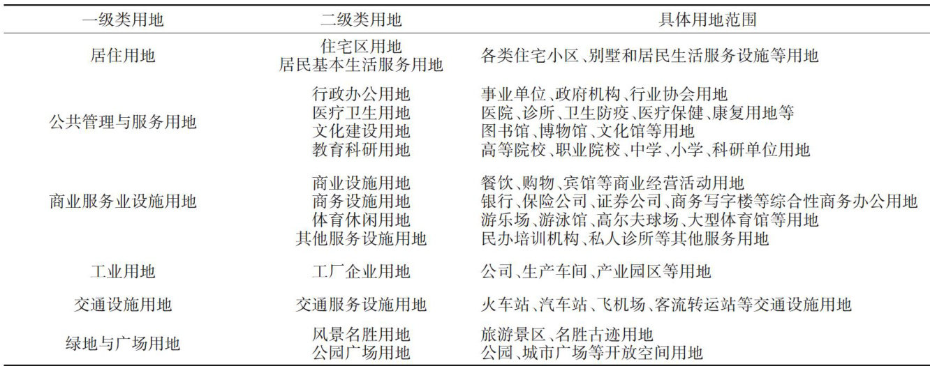
城市用地功能是城乡功能在特定地域空间中的体现,反映城市布局的基本形态和城乡功能区的空间差异[1。(剩余10819字)