基于5G物联网与实景三维的测量标志智能监管系统研究

打开文本图片集
中图分类号:TP393.4 文献标识码:A 文章编号:2096-4706(2026)04-0190-05
Abstract: Surveying marks serve as important national spatial infrastructure and surveying reference carriers.Their safetyandstabilityirectlyrelate toationalconomiconstruction,ationaldefensescurityientificesearch,adpise implementation of various enginering projects.Aiming at problems in traditional surveying mark management,such as backwardmanagementmethods,lowinspectionandmaintenanceefiencylackofreal-timemonitoring,andlaggeddamage response,thispaperdesignsandimplementsasetofintelligentsupervisionsystembasedon5GIntemetofThings,eal-scene 3D,Big Data,andartificial intellgene techology.Tissystemconstructsaspace-airground integrated dynamicpeception network throughintegratingsnsing technology,geospatialinformation technologyandmobilecommunicationtchology.It realizeseal-tie monitoringtellgent waing,preciseispection,and3Dvisualful-lifecycle managementforeyig marks.Application practice showsthatthissystem significantly improves theintellgent,informative,andrefined levelof surveying mark management.It provides powerful technical support for maintaining the securityof national surveyingreference and serving economic and social development.
KeyWords: surveying mark; 5G IoT; real-scene 3D;intelligent supervision; dynamic perception; Big Data analysis
0 引言
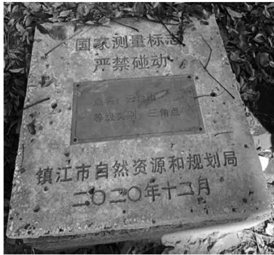
测量标志是测绘工作者辛勤劳动的结晶,也是国家基础地理信息系统的基础设施,作为空间位置定位的基准,是所有测绘工作的起点和基石[。(剩余6026字)