像控点布设对带状区域无人机倾斜摄影测量精度影响分析

打开文本图片集
【中图分类号】:P231 【文献标志码】:A 【文章编号】:1008-3197(2026)01-73-04
【DOI编码】:10.3969/j.issn.1008-3197.2026.01.015
Analysis of the Impact of Image Control Point Layout on the Precision of Unmanned Aerial Vehicle Tilt Photogrammetry in Strip Areas
WANG Lei1²,GU Yanfei 1,2* ,ZHANG Chao1,2,DONG Guangbin1,2,HAN Jiawang1,2 (1.JinanGeotechnical InvestigationandSurveying Research Institute,Jinan25o01,China;2.ShandongOpenData Innovationand ApplicationLaboratory,Jinan25O1O1,China)
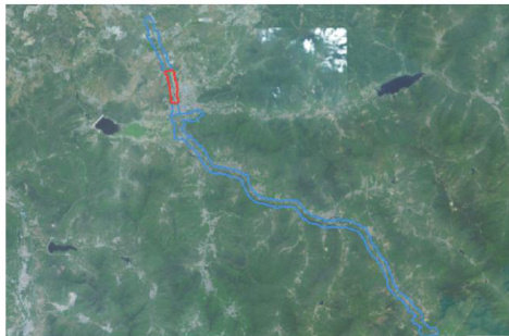
【Abstract】:Aimingatthedisadvantagesofinconvenientfieldlayoutof imagecontrolpoints intitl photogrammetryincomplex mountainous belt areas and the lack of relevant specifications for UAV oblique photogrammetry in belt scenes,such as regional network layout according to national specifications,and more field layout of image control points,this paper takes alarge-scale topographic map of UAVoblique photogrammetry in aprovincial road reconstruction and expansion project in Jinan as an example,designs four different layout schemes of image control points,and analyzes spatial accuracy and model accuracy afterdata acquisition and data processing,scheme two,three and four can meet the requirements of 1:500 scale accuracy. Scheme three only encrypts control points in the middle,which can notonly improve work eficiency,but also improve elevation accuracy.It is a belt area image.Provide reference for the layout of control points.
【Key words】: image control points; UAV;strip terrain maps;tilt photogrammetry;accuracy
在大型项目复杂山区带状地形图测量过程中,全站仪、RTK等传统测量方法效率低并受自然条件限制,通常无法满足工期要求。(剩余3518字)