CAM-ResNet:基于ResNet的土地利用类型遥感图像分类

打开文本图片集
[中图分类号]TP 751;P237[文献标志码]A[文章编号]1005-0310(2026)01-0049-06
CAM-ResNet: A Remote Sensing Image Classification Approach for Land Use Types Based on ResNet
WANG Zijian,FANG Jianjun, YUAN Yongbo,LIU Zeyu College of Urban Rail Transit and Logistics,Beijing Union University,Beijing 1O0101,China)
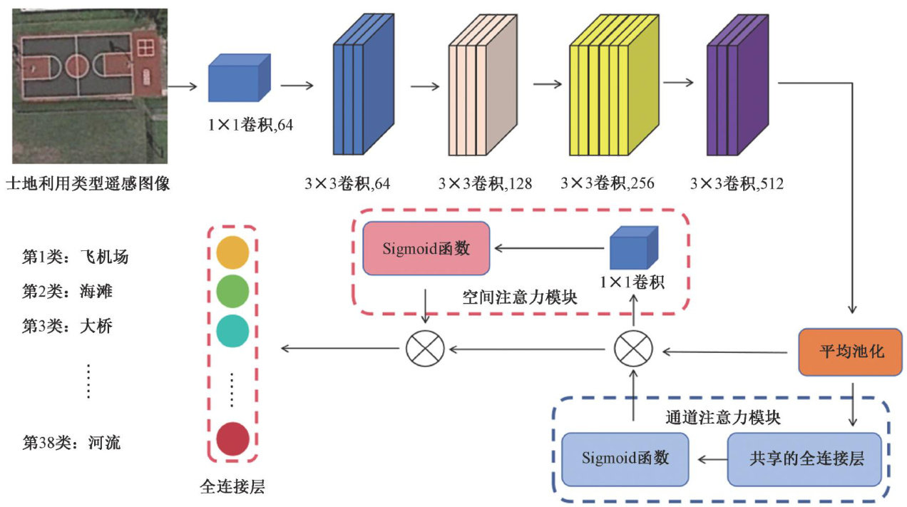
Abstract:In the field of land use type image clasification,traditional clasification methods face limitations in feature extraction accuracy and classfication precision,falling short of practical application requirements.This paper proposes CAM-ResNet,a novel network architecture that integrates the convolutional block atention module (CBAM) into the core ResNet5O framework to enhance feature representation,whileadopting automatic mixed precision(AMP)training to boost computational efficiency.Experimental results demonstrate that the overall accuracy of the CAM-ResNet network reaches 98.19% , outperforming the baseline ResNet50 by 10.16 percentage points.Ablation experiments further indicate that the CBAM attention mechanism significantly enhances the model's feature extraction capability,while the AMP training technology accelerates the model's convergence speed.The study validates the effectiveness and superiority of the CAM-ResNet network in remote sensing image classification for land use types.
Keywords:landuse;ResNet5O;convolutional block attention module(CBAM);automatic mixed precision (AMP) ;image classification;convolutional neural network (CNN)
0 引言
遥感技术作为一种获取地球表面信息的重要手段,已在众多领域得到广泛应用[1]。(剩余7456字)